


Snowshoes
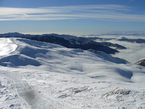
Panorama invernale
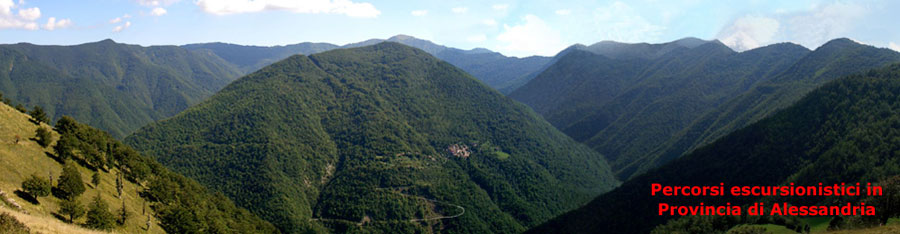
The ridges of the Apennines that from Tortona, passing through Volpedo, San Sebastiano Curone and Fabbrica Curone, rise up to Caldirola and Novi Ligure, passing through Serravalle Scrivia, Cantalupo Ligure until they reach Capanne di Cosola and Carrega and they are one of the most fascinating areas of the province of Alessandria.
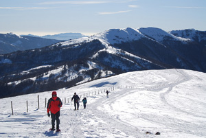
The ridge that touches the relieves of the Mount Giarolo (m. 1473), the Mount Ebro (m. 1700) and the Mount Chiappo (m. 1700) and divides the Curone valley from the Borbera valley, allows to range to 180 degrees on the territory of four Regions: Piedmont, Lombardy, Liguria and Emilia, offering an extraordinary view on the Apennines.
An unexpected and surprising spectacle can be enjoyed even from the summit of the Mount Antola (m. 1597), located at the south-east of Piedmont, from where, on clear days, the view ranges from the Ligurian Sea to a large part of the Alps.
Another area of great landscape value is that of the high Val Lemme and Alto ovadese, with the dorsal that starts from the Bocchetta Pass, passing through the Mount Leco and reaches the Mount Tobbio, offering panoramic views beyond compare.
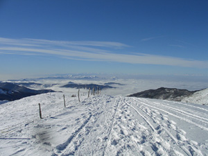
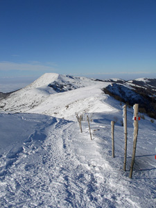
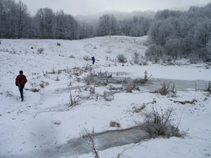
The first months of the year are characterized by optimum conditions for hiking on skis or snowshoes: the temperatures are often several degrees below freezing and the snow on average reaches a layer of 30-40 cm from with sides swept by the wind, so you walk or ski on compact crust on exposed stretches or, if you tackle the trails in the woods, on powdery snow.
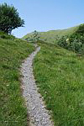
It's possible to reach the ridge by several points and then move slightly up and down the watershed, covering dozens of miles in safety: it is possible to reach a shelter or roads and is present the coverage of the major telephone operator .
ITINERARY
1 CALDIROLA – MONTE EBRO
Il Monte Ebro
Directions:
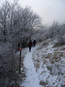
From the exit of Tortona climb up to the SP 100 of the Curone valley to Caldirola (km 35 + 500), coming to the end of the main road near the provincial Cologne; from the parking in front of the living centre of the Province, follow the path 106 that leads in one hour to Orsi Refuge, located on a plateau surrounded by a beautiful beech forest.
Verso il Rifugio Orsi
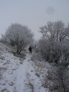
From the refuge it's easy to reach the ridge that leads to Mounts Panà, Gropà and Giarolo and follow the path 114 or continue on the path 106 to reach the Mount Ebro, from where you can go to Mount Chiappo.
Lungo il Sentiero 106
Il Sentiero 114
2 CAPANNE DI COSOLA – MONTE CHIAPPO
Directions: from the exit in Vignole Borbera (highway A/7) go up the Borbera valley, along the SP 140 to the pass of Capanne di Cosola (km 41 + 500); from the parking in front of the restaurant enter the path 105 that leads to Mount Chiappo 105 (m. 1700); shortly before the summit there is on the left a ridge leading to Mount Ebro (m. 1700), joining with the path described above.
Salita da Capanne di Cosola
Directions: from the highway exit of Vignole Borbera (A/7) go up the Borbera valley, along the SP 140 to km. 27.400, then take the SP 147, follow it until km. 15.700, where, shortly after the village of Capanne di Carrega (when there is the homonymous farm, open all year), there are on the right the indications of the path 200 that leads to the Mount Antola(m. 1597).
Alta Val Borbera
Just below the summit there is a refuge where you can learn more about at the link
http://www.parks.it/rif/parco.antola/
4 BOCCHETTA PASS - MOUNT OF FIGNE
Directions: from Gavi dates back to the SP 160 to the Bocchetta Pass (33.700 km), where on the right, take the path E1 that climbs the slopes of the Mount Leco and then comes to the Mount of Figna (m. 1172).
More at the link http://www.parks.it/parco.capanne.marcarolo/
5 EREMITI PASS - MOUNT TOBBIO
Directions: From Voltaggio walk along the SP 166 from the Morsone valley to the Eremiti Pass (4.700 km) , where you take the path 401 that goes up to the Mount Tobbio (m. 1092); from the Dagliola Pass you can take the detour that leads to the Mount of Figna, joining the previous route.
Further details at the link http://www.parks.it/parco.capanne.marcarolo/
Further information (maps, photographs, elevation profiles and descriptions of the trails) related to the proposed paths are available within the pages of site
servizioparchi@provincia.alessandria.it
Telephone 0131304546